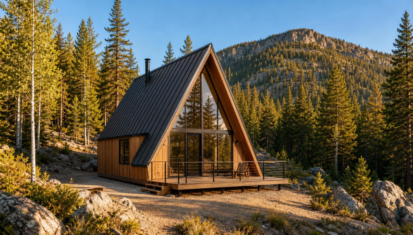
Clear Creek County, Colorado
8.94 shovel-ready acres in the mountains above Idaho Springs
The Humming Bird & Ontario patented lode claims — two adjoining patented lode claims of 4.470 acres each, sold together. Soda Creek running 50 yards off the north boundary, a graded building pad, roughly 80% of the driveway built, a recorded boundary survey, and engineered road drawings already in hand.
- Total acreage
- 8.94 acres
- 4.470 ac per 2026 county account record
- 2026 actual value
- $125,760
- $62,880 per county account; assessment is not market value
- 2026 estimated tax
- $2,465.40
- $1,232.70 per county account
- Tenure
- Patented claims
- fee-simple surface + minerals
Where it sits
Minutes from I-70, an hour from nothing at all
The land sits above Idaho Springs on Van Eden Road, backing to steep timbered ground with Soda Creek — annual flowing mountain runoff — 50 yards north-west of the north boundary. Close enough to the interstate for a Denver commute, far enough up the drainage to feel remote.
- Idaho Springs~3 miles
- I-70 corridorminutes
- Loveland Ski Area~25 min
- Downtown Denver~40 min
Latest county records · 2026
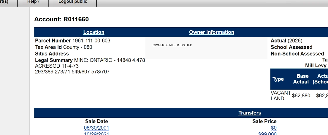
Two accounts, 4.470 acres each
Clear Creek County lists Humming Bird as account R011661 and Ontario as R011660: 8.94 acres combined, $125,760 combined actual value, and $2,465.40 combined estimated 2026 tax. Assessor values are for taxation and are not market appraisals.
Search Clear Creek County property records →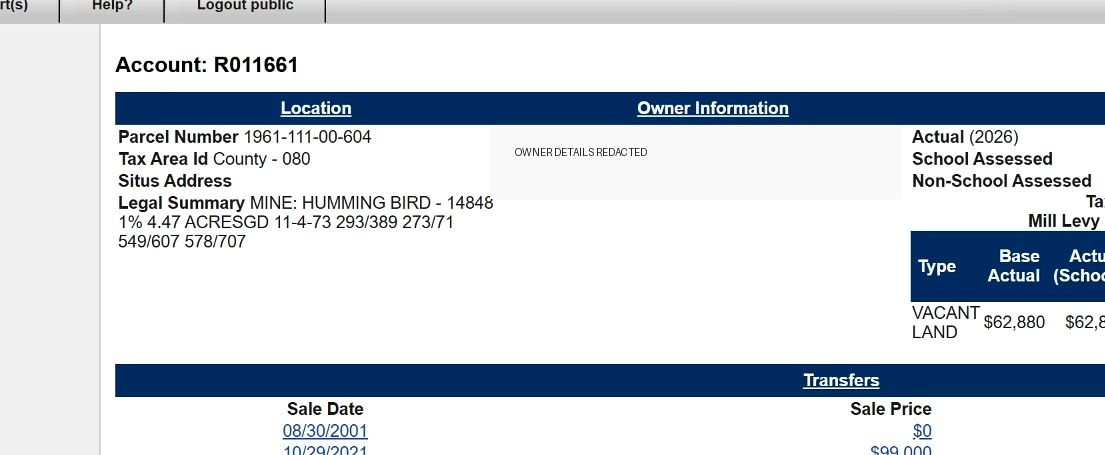
How to walk this property
Four steps, in order
At a glance
What makes this parcel different
Where the Colorado Gold Rush started
George Jackson's January 1859 strike at Chicago Creek is about two miles from this gate. The Argo Tunnel, Phoenix Gold Mine, and Edgar Mine are all within three miles, and these are named, patented gold lode claims.
See the gold country →Priced in the open, with the engineer included
Cheap, fair, and premium value bands for both claims against real Clear Creek County comparables — plus three post-sale civil engineering packages from the owner's licensed PE, carried to permit if you want it.
See value & services →Two patented lode claims, one parcel
Humming Bird and Ontario — 4.470 county-record acres each, 8.94 acres combined, with the common sideline drawn on the parcel map. Patented ground, not a leased claim.
See the claim split →Annual flowing Soda Creek, 50 yards out
Mountain runoff runs year-round about 50 yards north-west of the north boundary — the sound and the wildlife, without the parcel carrying the stream setback itself.
Read the water file →Codes and design loads, already pulled
2024 IRC, M-1 zoning, the county's 65 psf-plus snow band, well and septic rules — every figure linked to the agency source and reviewed against this site by a licensed PE.
Open the code register →Driveway roughly 80% built
Engineered civil drawings in hand for the remainder. Access is the line item that sinks mountain land deals, and most of it is already spent here.
See the road drawings →Off-grid upside, modeled honestly
Solar yield, battery autonomy, micro-hydro, Starlink, greenhouse, and a trout pond on the creek drainage — with real 2026 costs and the permits each one needs.
Run the numbers →Walk it in 3D before you drive up
A procedural terrain model over the surveyed boundary, with three scored scenarios: site the build, chase the sun, and load out the homestead.
Explore in 3D →At a glance
The full fact sheet
- Total acreage
- 8.94 acres4.470 ac per 2026 county account record
- 2026 actual value
- $125,760$62,880 per county account; assessment is not market value
- 2026 estimated tax
- $2,465.40$1,232.70 per county account
- Tenure
- Patented claimsfee-simple surface + minerals
- Elevation
- 8,000–8,580 ftUSGS 3DEP along the surveyed boundary
- Water nearby
- Soda Creek~50 yd NW of the north boundary
- Survey
- Completefull boundary survey on record
- Building pad
- Gradedsite work already started
- Driveway
- ~80% builtmountain access largely in
- Plans
- ~70% completemountain-home design set
- Utilities
- Off-gridwell/septic/power not yet installed
Ask for the full packet
Survey, engineered road drawings, plan sets, well logs, and current pricing — sent straight back to you.
Start an inquiry